Before I camped at the Valley of the Gods, I drove on to the town of Mexican Hat, Utah, to fill my cooler with supplies. On the way there, I noticed a road leading to Goosenecks national sanctuary, and another leading to Mexican Hat rock.
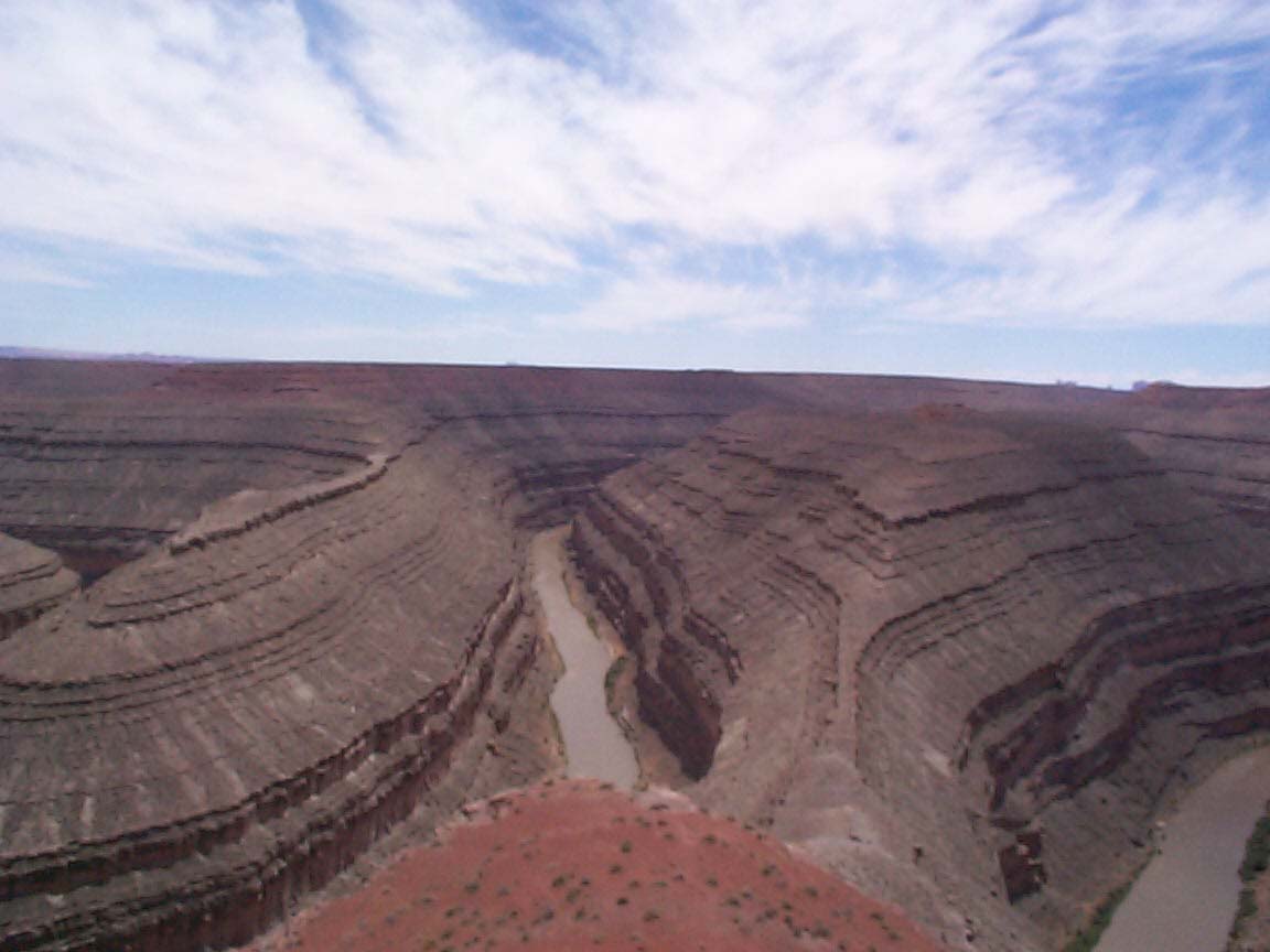
From Muley's Point, I had seen the rocky stairs of Glen Canyon leading deep down into the San Juan river below. I was amazed at how it seems to cut through the mostly flat valley all around it. As it came up right to the edge of the bluffs on which I stood, I didn't realize that it continues southward. I had no idea what the Goosenecks were supposed to be until I finally got there.
Driving towards it, it appears to be another spot in the middle of nowhere. But as I got closer, I could see it open up into a huge, deep canyon. The San Juan river takes two abrupt meanders at that point, long and curved like the necks of geese -- hence the name. I ate lunch there with a retired couple from California, took a few photos, and headed to Mexican Hat rock.